How Do Weather Satellites Work?
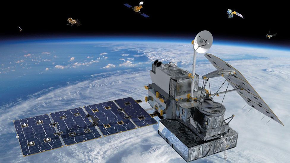
Weather satellites can see very long distances because they fly hundreds and sometimes thousands of miles above the Earth. They don’t have eyes to see with, but they do use special tools called radiometers (which are made up of sensors that allow them to scan the Earth and detect different types of energy.
After the satellites gather the information, they transmit it back to Earth, where it is collected and analyzed by meteorologists or people who study weather. This analysis is then put on television, the internet or other forms of media so that we know what kind of weather to expect.
NASA’S WEATHER FORECASTING SATELLITES & CONTRIBUTIONS
-
Television Infrared Observation Satellite (TIROS) project, America’s first weather satellite. Launched on April 1, 1960, from Cape Canaveral, Fla.,
-
On Aug. 28, 1964, NASA launched Nimbus 1, the first of its second-generation weather satellite series. Nimbus pioneered an improved television camera system and new infrared sensors for weather and atmospheric observations, while pointing continuously at Earth’s surface.
-
The Mission to Planet Earth (MTPE), was initiated by President George Bush in 1989, on the recommendation of the National Research Council . Now officially called the Earth Science Enterprise (ESE), is a program of the National Aeronautics and Space Administration (NASA) of the U.S. government.
-
The mission is to use spacecraft and space technology to provide a comprehensive scientific study of the earth’s living systems as viewed from space.
-
Using satellites with precise measuring equipment, the mission provide information about weather patterns, climate , oceans, coastlines, surface activity, atmospheric conditions, natural disasters, pollution , and hundreds of other measurements.
-
NASA also has the goal of using the program’s results to develop a “predictive capability” for climate, weather, and natural hazards.
-
In 1996 a Japanese satellite carried NASA instruments to study global wind patterns.
-
In 1997 a joint United States/Japanese satellite was launched to study how tropical rainfall affects the world’s climate.
-
In April 1999, NASA launched the Landsat 7 satellite to map and study environmental changes on the earth’s surface, including mapping the world’s forest canopy.
-
November 2000 a new generation of satellite was launched, the EO-1, which was only one-seventh the size of the Landsat satellites. The new satellite had sophisticated instruments may help scientists better understand ocean currents and heat movement between the poles.
-
The National Oceanic and Atmospheric Administration’s (NOAA) Polar-orbiting Operational Environmental Satellite is monitoring factors such as global vegetation, ocean currents, ice warming, weather patterns, ozone layer and solar storms
INDIAN WEATHER SATELLITES AND THEIR CONTRIBUTION
Cloud cover over India as seen by INSAT-3D - Click here
-
The INSAT series of satellites carrying Very High Resolution Radiometer (VHRR) have been providing data for generating cloud motion vectors, cloud top temperature, water vapour content, etc., facilitating rainfall estimation, weather forecasting, genesis of cyclones and their track prediction.
-
These satellites have also carried Data Relay Transponders (DRT) to facilitate reception and dissemination of meteorological data from in-situ instruments located across vast and inaccessible areas.
-
Currently, there are three meteorological satellites Kalpana-1, INSAT-3A and INSAT-3D in the geosynchronous orbit. Quick visualisation and analysis of data and products enable accurate weather assessments.
-
Space Applications Centre (SAC), ISRO, Ahmedabad has developed a weather data explorer application - Real Time Analysis of Products and Information Dissemination (RAPID) which is hosted in India Meteorological Department (IMD) website.
-
RAPID software acts as a gateway to Indian Weather Satellite Data providing quick interactive visualisation and 4-Dimensional analysis capabilities to various users like application scientists, forecasters, and the common man.